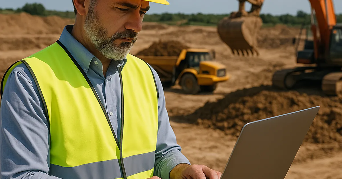
Dirt. It's the most fundamental material in construction—older than concrete, more abundant than steel, and more essential than any engineered product humanity has ever manufactured. Yet for decades, the way contractors sourced, moved, tested, and disposed of soil remained stubbornly analog in an increasingly digital world. A foreman's gut instinct, a handshake arrangement with a neighboring job site, and a paper manifest from a landfill characterized earthwork operations well into the 21st century.
That era is ending fast.
The convergence of artificial intelligence, Internet of Things (IoT) sensors, autonomous machinery, real-time data platforms, and sustainable engineering practices is producing what industry insiders now call smart dirt technologies—a suite of innovations that promise to make earthwork operations faster, safer, more cost-effective, and dramatically more sustainable. The global construction technology market, valued at approximately $1.87 billion in 2022, is projected to reach $13.9 billion by 2030, growing at a compound annual growth rate (CAGR) of nearly 28% according to Grand View Research. Earthwork and soil management represent one of the fastest-growing segments within that expansion.
This article takes a comprehensive look at the technologies, regulatory frameworks, market forces, and real-world applications reshaping how the construction industry interacts with the ground beneath its feet.
What Are Smart Dirt Technologies? Defining the New Paradigm
The term "smart dirt technologies" encompasses a broad ecosystem of tools, platforms, and methodologies designed to introduce intelligence—data, connectivity, automation, and analytics—into earthwork and soil management operations. These innovations span the entire lifecycle of dirt: from subsurface investigation and soil classification, through excavation and grading, to material reuse, transport logistics, and final placement or disposal.
At its core, smart dirt technology addresses three persistent pain points that have plagued earthwork contractors for generations:
- Information asymmetry — Contractors rarely know where compatible fill material exists nearby, forcing expensive off-haul to landfills when surplus soil from one site could perfectly serve another.
- Quality uncertainty — Without continuous monitoring, soil compaction, moisture content, and contamination status remain guesswork until costly problems emerge.
- Operational inefficiency — Fleet routing, equipment utilization, and material volumes are frequently managed through experience and estimation rather than real-time optimization.
Smart dirt technologies attack all three problems simultaneously. They range from the deceptively simple—smartphone apps that match dirt buyers with dirt sellers—to the genuinely complex, such as machine learning algorithms that predict subsurface conditions from surface sensor arrays.
The Four Pillars of Smart Dirt Innovation
- Sensing and monitoring: Embedded soil sensors, drone-based LiDAR surveys, and GPS machine control systems that generate continuous data streams about ground conditions.
- Data platforms and marketplaces: Cloud-based systems that aggregate project data, facilitate material exchanges, and optimize logistics across regions and project portfolios.
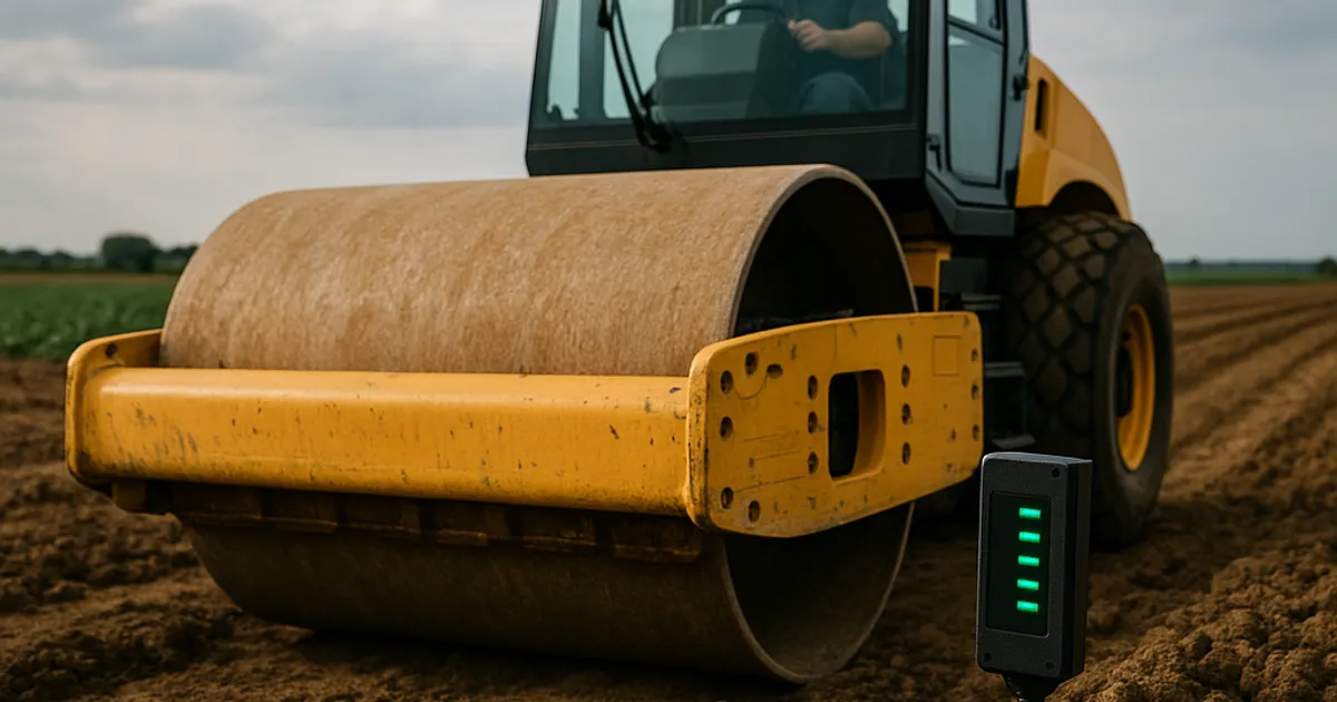
- Autonomous and semi-autonomous machinery: GPS-guided dozers, autonomous haul trucks, and robotic compaction equipment that reduce human error and improve precision.
- Advanced materials engineering: Treated soils, geopolymer stabilizers, recycled aggregate blends, and bioengineered fill materials that expand what qualifies as usable "smart dirt."
Understanding these four pillars provides the framework for examining each technology category in depth.
The Rise of Precision Grading: GPS and Machine Control Systems
For most of construction history, earthwork grading was guided by stakes, string lines, and the skill of experienced operators. A grade checker would walk a site multiple times daily, measuring cut and fill depths against design plans and communicating corrections to equipment operators. The process was labor-intensive, prone to error, and dependent on good weather and clear sightlines.
Modern GPS machine control systems have fundamentally changed this dynamic. Systems from companies like Trimble, Topcon, and Leica Geosystems equip bulldozers, motor graders, and excavators with multi-constellation GNSS receivers, inertial measurement units (IMUs), and hydraulic control interfaces that allow the machine itself to execute grade designs with centimeter-level accuracy.
How GPS Machine Control Works
The process begins with a 3D digital terrain model (DTM) derived from survey data, drone photogrammetry, or LiDAR scanning. This model is loaded into the machine control system's onboard computer. As the machine operates, its GPS receivers track position in real time. The system continuously compares the current blade or bucket position to the target design surface and automatically adjusts hydraulics to achieve the specified grade—without the operator needing to manually measure or estimate.
The productivity gains are substantial and well-documented:
- Caterpillar reports that GPS-guided grading can reduce re-work by up to 50% and cut staking costs by 75-80%.
- Studies published by the National Institute of Standards and Technology (NIST) have found that improved spatial data management in construction can reduce project costs by 15-25%.
- A 2021 report from the Associated General Contractors of America found that contractors using machine control technology completed earthwork phases 20-30% faster than those relying on traditional methods.
For large-scale infrastructure projects—highway construction, airport runway grading, large commercial site development—these efficiency gains translate to millions of dollars in savings. A highway interchange project that might have taken 18 months of earthwork under traditional methods can now be completed in 12-13 months with full GPS machine control deployment.
3D Modeling and Drone Survey Integration
Complementing machine control is the explosive growth of drone-based survey technology. Using photogrammetry or LiDAR sensors, construction drones can survey a 100-acre site in under two hours—a task that would take a ground survey crew several days. The resulting point cloud data is processed into high-resolution 3D models accurate to within 2-3 centimeters under optimal conditions.
This capability has made continuous volumetric tracking practical for the first time. Instead of monthly survey visits to estimate how much material has been moved, project managers can fly the site weekly or even daily, generating cut/fill progress reports that keep projects on schedule and budgets in check. Companies like DroneDeploy and Pix4D report that their construction customers perform an average of 12 surveys per month on active earthwork sites, compared to 1-2 surveys per month using traditional ground methods.
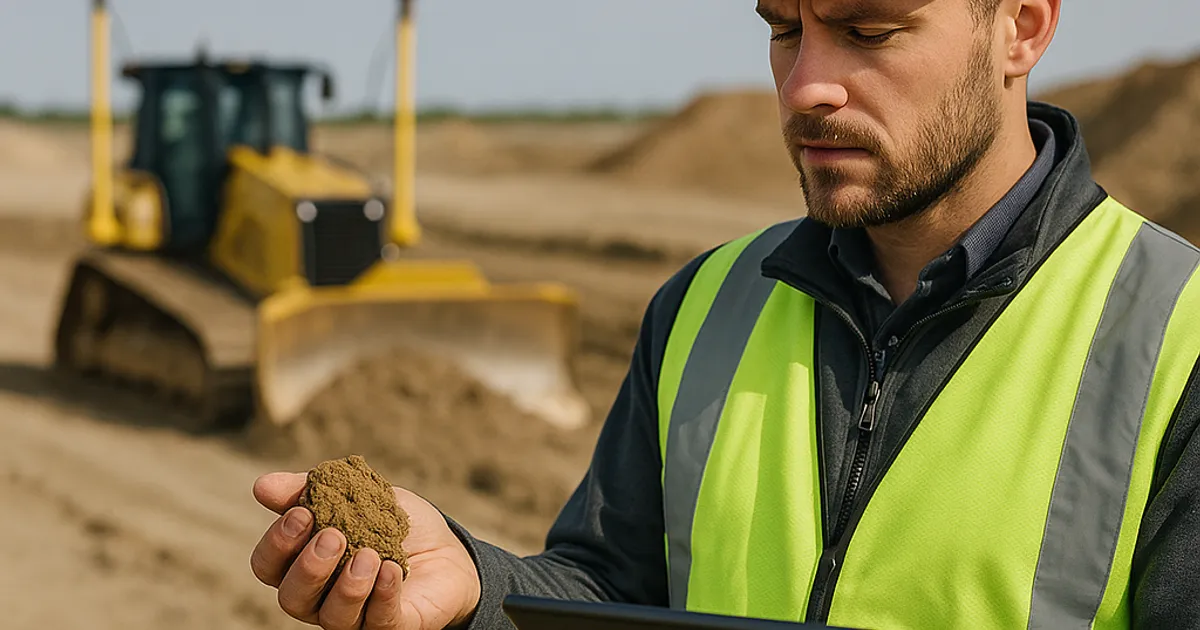
IoT Soil Sensors and Real-Time Ground Intelligence
Beneath the surface of every construction site lies a dynamic, complex system that traditional engineering treats as largely static once characterized by a geotechnical investigation. Smart dirt technologies are beginning to change that assumption by deploying IoT sensor networks that monitor soil conditions continuously throughout construction and beyond.
What IoT Soil Sensors Measure
Modern soil sensing technology can track a remarkable range of parameters in real time:
| Parameter | Sensor Technology | Why It Matters |
|---|---|---|
| Volumetric water content | Time-domain reflectometry (TDR) | Determines compactability and bearing capacity |
| Soil temperature | Thermistor arrays | Affects freeze-thaw stability and curing of treated soils |
| Electrical conductivity | Electromagnetic induction | Indicates salinity, contamination potential |
| Pore water pressure | Vibrating wire piezometers | Critical for slope stability and retaining wall design |
| Settlement/deformation | MEMS tilt sensors, extensometers | Detects unexpected movement in real time |
| Compaction density | Nuclear density gauge or non-nuclear alternatives | Verifies specification compliance per ASTM D6938 |
The Regulatory Push for Better Soil Data
Regulatory requirements are accelerating IoT adoption in earthwork. The EPA's Construction General Permit (CGP) requires that sites disturbing one or more acres implement stormwater pollution prevention plans (SWPPPs) with documented inspection and monitoring. Smart sensor networks can automate much of this monitoring, reducing compliance burden while improving data quality.
OSHA's excavation and trenching standards (29 CFR 1926 Subpart P) require soil classification before workers enter any excavation deeper than five feet. Traditionally, this classification relied on visual inspection and simple manual tests. Newer sensor-based classification tools can provide quantitative data that supplements or replaces subjective visual assessment, reducing liability and improving safety outcomes.
The ASTM International standards body has been actively developing test methods that accommodate sensor-based and automated testing approaches. ASTM D7928 (particle size analysis), ASTM D4318 (Atterberg limits), and ASTM D1557 (compaction testing) are all being revisited to address digital and automated testing methodologies.
Case Study: Smart Monitoring in Seattle's Infrastructure Projects
In the Pacific Northwest, where glacial till, soft marine clays, and the ever-present risk of landslides create complex earthwork environments, IoT monitoring is becoming standard practice on major infrastructure projects. Seattle-area contractors managing projects near Puget Sound frequently deploy slope stability monitoring arrays that transmit continuous piezometer and inclinometer readings to cloud dashboards, enabling geotechnical engineers to monitor conditions remotely and intervene before problems escalate. For contractors involved in the dirt exchange in Seattle ecosystem, real-time soil quality data also makes it easier to confirm that surplus material meets quality standards before it's transported to a receiving site.
Digital Marketplaces: Solving the Dirt Logistics Problem
Of all the smart dirt innovations transforming construction, perhaps none has greater near-term impact than digital material exchange platforms. The core problem they solve is deceptively simple but economically enormous: every day across North America, contractors pay to haul surplus soil to landfills while, just miles away, other contractors pay to import fill material from distant quarries. Both parties lose money. Both contribute unnecessarily to truck traffic, carbon emissions, and landfill use.
The traditional dirt brokerage model—phone calls, local knowledge, and informal referral networks—was too slow, too limited in geographic scope, and too opaque to efficiently match supply with demand at scale. Digital platforms change all of that.
How Digital Dirt Marketplaces Work
Modern dirt exchange platforms function similarly to other two-sided digital marketplaces, connecting material suppliers (excavators with surplus soil, construction companies completing site work) with material buyers (contractors needing fill, landscape companies, road builders) through a searchable, filterable online interface.
Key features of mature platforms include:
- Geospatial matching: Algorithms identify the closest compatible material source to each demand location, minimizing haul distances and transportation costs.
- Material specification filtering: Users can search by soil type (select fill, common fill, topsoil, crushed aggregate, etc.), quantity, and quality characteristics.
- Availability and timing coordination: Platforms allow users to specify when material will be available or needed, enabling just-in-time logistics planning.
- Documentation support: Manifests, material certifications, and chain-of-custody records can be managed within the platform, supporting regulatory compliance.
DirtMatch has emerged as a leading platform in this space, connecting earthwork contractors with compatible material sources and destinations across the country. By aggregating supply and demand data across thousands of active projects, DirtMatch enables matches that would never occur through traditional networking—a subdivision developer in the suburbs finding a perfect fit with a commercial grading contractor across town who needs exactly the soil type being excavated.
The economic impact of efficient dirt matching is substantial. Transportation accounts for 60-70% of the total cost of soil disposal and procurement in most markets. Every mile eliminated from a haul route translates directly to cost savings. Industry estimates suggest that well-executed dirt matching programs can reduce total earthwork logistics costs by 30-45% on compatible projects.
Regional Market Dynamics
The economics and logistics of dirt exchange vary considerably by region, reflecting differences in development intensity, soil types, regulatory requirements, and local market structures.
In high-growth Western metros like Denver and Los Angeles, rapid suburban expansion creates massive volumes of surplus native soil that frequently struggles to find compatible destinations. The dirt exchange in Denver market has seen particularly strong growth as Front Range development projects generate millions of cubic yards of excavated material annually. Similarly, the dirt exchange in Los Angeles operates in one of the nation's most complex regulatory environments, where contamination concerns and strict disposal requirements make finding permitted, compatible receiving sites critically important.
In established coastal markets like San Francisco and Boston, where available land is scarce and development occurs primarily through infill and redevelopment, contaminated soil management and brownfield remediation drive much of the dirt exchange activity. The dirt exchange in San Francisco reflects the Bay Area's particular challenges: expansive Bay Mud, seismic considerations, and some of the nation's strictest environmental regulations create a complex material management environment where smart matching tools provide exceptional value.
Autonomous and Semi-Autonomous Earthmoving Equipment
The autonomous vehicle revolution that has captured headlines in consumer transportation has a less-publicized but equally transformative analog in heavy construction equipment. Autonomous and semi-autonomous earthmoving machinery is moving from experimental prototype to commercial deployment at an accelerating pace, with implications for productivity, safety, and the economics of earthwork.
Levels of Autonomy in Construction Equipment
Borrowing from the automotive industry's autonomy framework, construction equipment autonomy is typically categorized on a scale from Level 1 (driver assistance) to Level 5 (full autonomy). Most commercially deployed systems today operate at Levels 2-3:
- Level 2: Machine control provides automated blade or bucket positioning while the human operator controls movement and direction. This is standard GPS machine control, widely deployed today.
- Level 3: Conditional automation where the machine can execute defined tasks (like a compaction pass) without continuous operator input, but requires human oversight and intervention capability.
- Level 4: High automation within geofenced operational domains—the machine can complete entire work cycles without human input within a defined area.
- Level 5: Full autonomy across all conditions. Not yet commercially available in earthmoving.
Commercial Deployments and Performance Data
Komatsu's Smart Construction initiative has deployed semi-autonomous excavators and dump trucks at quarry and mining operations in Japan and Australia, reporting productivity increases of 25-30% compared to conventional operations. The company's autonomous haulage system (AHS) has logged over 5 billion tons of material moved in mining applications—a technology base that is actively being adapted for construction earthwork.
Caterpillar's Command for Dozing system allows a single remote operator to supervise multiple dozers simultaneously, each executing GPS-guided grading tasks with minimal human intervention. Early deployments report that one operator can manage 3-4 machines, compared to the 1:1 ratio of conventional operations.
Built Robotics (acquired by Exodigo) developed an autonomy kit that can be retrofitted to standard excavators, enabling Level 4 operation for trenching and grading tasks in defined work zones. Their systems have been deployed on utility installation projects across California and Texas.
Safety Implications
The safety case for autonomous earthmoving equipment is compelling. According to OSHA, earthmoving equipment incidents account for a significant portion of construction fatalities annually. Struck-by incidents involving heavy equipment, rollover accidents, and caught-in/between hazards are disproportionately represented in construction fatality statistics.
Autonomous systems eliminate human exposure to the most dangerous operational scenarios. When a dozer is operating in a slope failure zone, when a truck is navigating a narrow haul road at the edge of a fill slope, or when an excavator is working near unstable trench walls, removing the human from the cab eliminates the most severe injury potential. Early safety data from autonomous construction equipment deployments suggests incident rates 60-80% lower than comparable conventional operations.
Advanced Soil Treatment and Engineered Fill Technologies
Not all smart dirt technologies involve digital hardware. Some of the most impactful innovations in earthwork involve the chemical and mechanical treatment of soil itself—transforming marginal or problematic native materials into high-performing engineered fill that meets modern construction specifications.
Soil Stabilization: Chemistry Meets Earthwork
Traditional soil stabilization using lime and Portland cement has been practiced for decades, but modern approaches have become significantly more sophisticated. Current stabilization technologies include:
Lime treatment remains the workhorse for clay-rich soils. When hydrated lime is mixed with high-plasticity clay, calcium ions replace sodium ions on clay particle surfaces, reducing plasticity, improving workability, and increasing strength. Projects using lime stabilization can often achieve CBR (California Bearing Ratio) values 10-20 times higher than untreated clay soils.
Fly ash and slag cement stabilization leverage industrial byproducts to create pozzolanic reactions in marginal soils. These materials, governed by ASTM C618 (fly ash) and ASTM C989 (slag cement) standards, can transform soft, wet soils into stable working platforms at costs significantly below soil replacement alternatives.
Geopolymer stabilizers represent the emerging frontier. These proprietary formulations—including products from companies like Uretek, Alchemy Geosystems, and TerraFirma—use alkali-activated binder chemistry to achieve treatment results with lower carbon footprints than traditional Portland cement-based approaches. Some geopolymer systems can treat soils at ambient temperature without the extended curing periods required by lime treatment.
Biostabilization is an emerging field that uses microorganisms—particularly those producing microbially induced calcite precipitation (MICP)—to cement soil particles together through biological processes. While still largely in research and demonstration phases, MICP has shown promising results in laboratory and small-scale field tests, with University of California, Davis researchers demonstrating significant strength improvements in loose sandy soils treated with Sporosarcina pasteurii bacteria cultures.
Recycled Aggregate and Reclaimed Material Integration
Smart earthwork increasingly means maximizing the use of recycled materials in fill and base construction. Recycled concrete aggregate (RCA), reclaimed asphalt pavement (RAP), and coal combustion products (CCPs) are all finding growing roles in engineered fill applications.
The environmental and economic drivers are powerful:
- RCA can be produced at 30-50% lower cost than quarried aggregate in many markets.
- Using RCA reduces demand for virgin quarried material, lowering quarry impacts and transportation distances.
- Many state DOTs now have approved specifications for RCA use in road base and embankment fill. ASTM D6938 and state-specific standards govern quality and application.
For contractors working in markets where digital platforms facilitate dirt and aggregate exchange, recycled material streams represent a significant opportunity. How DirtMatch works demonstrates how contractors can list not just native soil but also recycled aggregate, crushed concrete, and other reusable materials—creating a circular economy for construction materials that benefits all parties.
Find or Post Dirt, Rock & Aggregate
Join thousands of contractors using DirtMatch to buy, sell, and exchange earthwork materials.
Try DirtMatch FreeAI and Machine Learning in Earthwork Planning and Optimization
Artificial intelligence is beginning to penetrate earthwork planning in ways that promise to fundamentally change how projects are designed, scheduled, and executed.
AI-Powered Site Investigation
Traditional geotechnical investigation involves drilling borings or excavating test pits at discrete locations across a site, then interpolating subsurface conditions between sampling points. This approach leaves significant uncertainty—a boring every 100 feet still leaves 9,999 square feet of unknown ground between each data point.
Emerging AI approaches use machine learning to integrate multiple data sources into probabilistic subsurface models that are far more comprehensive than traditional interpolation:
- Ground-penetrating radar (GPR) data processed through neural networks can identify subsurface anomalies, layer boundaries, and buried utilities with greater accuracy than human interpretation alone.
- Electromagnetic induction (EMI) surveys combined with sparse boring data and ML models can produce continuous estimates of soil type and consistency across entire sites.
- Historical boring database integration: AI systems trained on regional boring databases can provide prior probability distributions for subsurface conditions that refine site-specific investigation programs.
Earthwork Mass Balance Optimization
One of the most computationally intensive tasks in earthwork planning is mass haul optimization—determining the most cost-effective way to move cut material to fill areas within a project, minimizing haul distances and equipment cycles. Traditional methods use haul diagrams and experienced estimator judgment. Modern optimization algorithms can evaluate thousands of possible material movement scenarios in seconds, identifying solutions that human planners would be unlikely to discover.
Software platforms like HCSS, B2W Software, and Agtek integrate mass balance optimization with equipment fleet modeling to generate earthwork execution plans that minimize cost while meeting project schedule constraints. Integration with GPS machine control systems allows these plans to be executed with precision that manual methods cannot match.
Predictive Analytics for Risk Management
AI-powered predictive analytics are also transforming earthwork risk management. By analyzing historical project data—weather patterns, soil conditions, equipment performance, labor productivity—these systems can identify leading indicators of schedule delays, cost overruns, and quality failures before they manifest.
For example, predictive models trained on thousands of compaction test records can identify soil moisture conditions that historically correlate with failing compaction tests, alerting project teams to take corrective action (aeration, lime treatment, or operational delay) before the situation results in specification non-compliance and required remediation.
Sustainability and the Circular Economy in Earthwork
Smart dirt technologies are not just making earthwork more efficient—they're making it dramatically more sustainable. The construction industry accounts for approximately 39% of global carbon emissions, with a significant fraction attributable to material extraction, processing, and transportation. Smart earthwork practices directly address these impacts.
Quantifying the Environmental Impact of Traditional Earthwork
The environmental cost of conventional earthwork operations is substantial:
- A standard diesel dump truck traveling a 10-mile haul route emits approximately 4.5 kg of CO₂ per trip. A large earthwork project might involve 50,000+ truck trips over its duration.
- Landfill disposal of clean construction soil wastes valuable fill material while consuming finite landfill capacity and generating leachate and methane as organic matter decomposes.
- Virgin aggregate extraction from quarries involves habitat disruption, dust and noise pollution, and irreversible landscape change.
How Smart Technologies Reduce Environmental Impact
Material matching platforms are among the highest-impact sustainability tools available to the earthwork industry. By connecting surplus soil from excavation projects with sites that need fill material, these platforms can eliminate or dramatically reduce truck haul distances and landfill disposal. A study of material exchange programs in the Netherlands found that coordinated dirt matching reduced truck kilometers driven by up to 60% compared to conventional disposal and procurement patterns.
GPS machine control reduces environmental impact by minimizing over-excavation and re-work. When a grading project achieves design grades on the first pass rather than the third, less material is disturbed, fewer equipment hours are burned, and less fuel is consumed.
Soil treatment and stabilization eliminates the need to import select fill material in many cases, dramatically reducing the truck traffic and quarrying impacts associated with fill procurement. Treating and reusing native soil is almost always the lowest-impact option from a lifecycle perspective.
Regulatory and Incentive Landscape
The policy environment is increasingly supportive of sustainable earthwork practices. EPA's Beneficial Use of Secondary Materials program encourages the reuse of industrial byproducts like fly ash, slag, and foundry sand in construction applications. Multiple states have adopted programs that facilitate clean soil reuse by streamlining regulatory approval for transfers between construction sites, reducing the administrative burden that has historically discouraged material matching.
LEED certification programs include credits for construction waste diversion and regional material sourcing that can be earned through effective earthwork material management—providing an economic incentive for project owners to prioritize smart dirt practices.
The Role of Data Platforms in Connecting the Earthwork Ecosystem
All of the technologies discussed above generate data—enormous volumes of it. GPS machine control systems, IoT sensors, drone surveys, equipment telematics, and material tracking systems collectively produce data streams that would overwhelm traditional management approaches. The intelligence value of this data is only realized when it can be aggregated, analyzed, and acted upon across the entire earthwork ecosystem.
Cloud Platforms and Project Data Integration
The emergence of cloud-based construction management platforms has created the technical infrastructure to aggregate and analyze earthwork data at scale. Platforms like Procore, Autodesk Construction Cloud, and industry-specific solutions integrate data from multiple sources into unified project dashboards that provide unprecedented visibility into earthwork operations.
For the dirt and aggregate exchange market specifically, data platform capabilities enable:
- Real-time material availability updates: When a grading contractor completes an excavation phase, surplus material availability can be instantly broadcast to nearby projects that may need fill.
- Quality documentation chains: Material certifications, testing records, and delivery manifests can be maintained digitally from source site to receiving site, simplifying regulatory compliance.
- Market analytics: Aggregated data on material supply, demand, and pricing across regions helps contractors and project owners make better procurement decisions.
For contractors ready to leverage these capabilities, getting started with DirtMatch provides access to one of the most comprehensive earthwork material exchange networks in the country, with tools designed specifically for the way earthwork contractors operate.
The Future: Integrated Digital Twins for Earthwork Sites
The logical endpoint of current technology trajectories is the digital twin—a comprehensive, continuously updated virtual model of a construction site that integrates subsurface data, surface conditions, material quantities, equipment positions, and project schedule in a single dynamic model.
Digital twins for earthwork sites are not science fiction. Several major infrastructure projects—including segments of California's High Speed Rail and several large airport expansion programs—are already using digital twin approaches to manage complex earthwork operations. As the cost of sensors, cloud computing, and software development continues to decline, digital twin capabilities will become accessible to mid-size and smaller earthwork contractors within the next 5-7 years.
Workforce Development and the Human Side of Smart Earthwork
Technology adoption in earthwork creates both opportunities and challenges for the construction workforce. Understanding the human dimension of this transformation is essential for contractors, educators, and policymakers.
New Skills for the Smart Dirt Era
The earthwork workforce of 2030 will need capabilities that were barely relevant in 2015:
- GPS machine control operation: Equipment operators must understand 3D machine control systems, be able to troubleshoot common problems, and interpret digital grade displays. Many operators who excelled with conventional methods require significant retraining.
- Drone operation and data interpretation: Some earthwork contractors are building in-house drone survey capability, requiring licensed Part 107 drone pilots who can also process and interpret photogrammetric data.
- Data platform proficiency: Foremen and project managers must be able to use cloud-based project management tools, interpret sensor data dashboards, and contribute to digital documentation workflows.
- Equipment telematics management: Interpreting fleet management data, identifying maintenance needs from diagnostic codes, and using utilization data to optimize fleet deployment require analytical skills new to many earthwork operations.
Training Resources and Industry Response
The construction industry's training infrastructure is adapting, though not always quickly enough. The Associated Builders and Contractors (ABC) and Associated General Contractors of America have both developed training programs that incorporate technology-focused modules into traditional craft apprenticeship curricula. Community college construction technology programs are increasingly offering GPS machine control and construction data management courses.
Equipment manufacturers have also invested heavily in training infrastructure. Caterpillar's Cat® Simulators allow operators to practice machine control operation in virtual environments before sitting in an actual cab. Komatsu's Smart Construction Remote program enables remote monitoring and coaching that supports ongoing skill development in the field.
Competitive Landscape: Who's Building the Smart Dirt Future
The smart dirt technology market involves an increasingly diverse set of players, from legacy heavy equipment manufacturers to venture-backed construction technology startups.
Key Players by Technology Category
| Category | Key Players | Market Position |
|---|---|---|
| GPS Machine Control | Trimble, Topcon, Leica Geosystems | Established market leaders |
| Drone Survey | DroneDeploy, Pix4D, Skycatch | Rapid growth, consolidating |
| Autonomous Equipment | Komatsu (AHS), Caterpillar (Command), Built Robotics | Early commercial deployment |
| IoT Soil Sensing | Sentek, Stevens Water, Campbell Scientific | Fragmented, niche-specific |
| Material Exchange Platforms | DirtMatch, CivilTracker, Fill-Link | Growing, regional variation |
| Construction AI/Analytics | ALICE Technologies, Buildots, Versatile | Startup-driven innovation |
| Soil Treatment | Uretek, Alchemy Geosystems, TerraFirma | Specialty service providers |
For contractors evaluating material exchange platforms specifically, DirtMatch Pro offers advanced features designed for contractors managing multiple simultaneous projects, with enhanced matching algorithms and priority listing capabilities that ensure your material supply or demand reaches the most relevant counterparties first.
Investment Trends
Venture capital investment in construction technology broadly—and earthwork technology specifically—has surged over the past five years. The sector attracted over $4.5 billion in venture investment in 2022 according to McKinsey's Global Construction Report. While the 2023-2024 period saw some market correction, strategic investment from both venture funds and major construction equipment manufacturers continues at elevated levels compared to pre-2018 baselines.
The strategic logic for equipment manufacturers is particularly compelling: the transition to autonomous and connected equipment creates recurring software and data service revenue streams that complement and eventually may exceed traditional hardware sales margins.
Implementation Roadmap: Adopting Smart Dirt Technologies in Your Operations
For earthwork contractors ready to move beyond awareness into action, a practical implementation roadmap helps prioritize investments and sequence adoption to maximize return.
Phase 1: Data Foundation (Months 1-6)
Before investing in advanced automation, contractors should establish the data infrastructure that makes subsequent technologies effective:
- Implement fleet telematics on all major equipment if not already in place. Most major OEMs now include telematics as standard equipment, but ensuring data is actively monitored and acted upon is the critical step.
- Adopt a cloud-based project management platform that supports document management, daily reporting, and basic analytics. This creates the data culture and infrastructure for more advanced tools.
- Establish baseline metrics for key performance indicators: equipment utilization rates, fuel consumption per unit of work, material haul distances, compaction pass counts, and rework frequency.
- Join a material exchange platform to immediately address logistics inefficiencies. The ROI on platform membership is typically achieved within the first project where a haul is avoided or shortened significantly.
Phase 2: Precision Operations (Months 6-18)
- Deploy GPS machine control on your primary grading equipment. Begin with a single dozer or motor grader to build operator proficiency before fleet-wide rollout.
- Integrate drone survey capability either through in-house Part 107 certification or a contracted survey service. Establish weekly survey protocols on active earthwork projects.
- Implement IoT monitoring on projects with soil quality risk factors—high-plasticity clays, sites near water, projects with tight compaction specifications.
Phase 3: Advanced Automation and Analytics (Months 18-36)
- Evaluate semi-autonomous equipment for high-volume, repetitive tasks within your operational mix.
- Adopt AI-powered planning tools for mass haul optimization and earthwork scheduling.
- Develop digital twin capabilities for your most complex projects, integrating survey, sensor, and machine data into unified project models.
Return on Investment Expectations
| Technology | Typical Payback Period | Primary Value Driver |
|---|---|---|
| GPS Machine Control | 12-24 months | Reduced rework, faster completion |
| Drone Survey | 6-12 months | Eliminated survey costs, better volumetrics |
| Fleet Telematics | 6-18 months | Fuel savings, maintenance optimization |
| Material Exchange Platform | 1-3 projects | Reduced haul costs, eliminated disposal fees |
| IoT Soil Monitoring | Project-specific | Risk mitigation, specification compliance |
| Semi-Autonomous Equipment | 24-48 months | Labor productivity, safety improvement |
Conclusion: The Ground Is Shifting—Are You Ready?
The future of earthwork is being written today, in lines of code, sensor arrays, autonomous control algorithms, and digital marketplace connections that are fundamentally changing what it means to work with dirt, rock, and aggregate. Smart dirt technologies are not distant concepts awaiting some future breakthrough—they are available, commercially proven, and being adopted by forward-thinking contractors right now.
The contractors who thrive in the next decade of construction will be those who treat soil not as an undifferentiated commodity to be moved and disposed of, but as a managed resource to be tracked, characterized, optimized, and—where possible—reused. They will use data to make decisions that formerly relied on intuition. They will connect with counterpart contractors through digital platforms to create value that neither could generate alone. They will deploy machines with precision that reduces waste, rework, and environmental impact simultaneously.
The ground beneath every construction project is smarter than we've given it credit for. Smart dirt technologies are finally giving us the tools to understand it, work with it more effectively, and build on it more sustainably. Whether you're managing a small site prep project or a multi-year infrastructure program, the path to smarter earthwork operations begins with a single step: embracing the data and digital tools that are already transforming the industry around you.
For contractors looking to start with one of the highest-ROI smart dirt technologies available today, DirtMatch provides immediate access to the nation's growing network of earthwork material exchange—connecting your surplus soil with contractors who need it, and helping you find the fill you need without the unnecessary hauls that drain project budgets and inflate carbon footprints.